|
¥”18 άΦΆ÷–“ΕΘ§”ΔΙζœ»Κσ¥ρΑήΝΥΈςΑύ―άΓΔΚ…άΦΚΆΖ®ΙζΘ§»ΓΒΟΝΥΚΘ…œΑ‘÷ςΒΡΒΊΈΜΘ§≥…ΈΣ άΫγ…œΉν«Ω¥σΒΡ÷≥ΟώΙζΦ“Θ§≤ΔΩΣΤτΝΥΙΛ“ΒΗοΟϋΓΘΒΫ19 άΦΆΘ§‘ΎΙΛ“ΒΗοΟϋΆΤΕ·œ¬¥σ”ΔΒέΙζ¥οΒΫ»Ϊ ΔΘ§≥…ΈΣΓΑ»’≤Μ¬δΒέΙζΓ±ΓΘΤδΩΤ―ßΦΦ θΒΡœ‘÷χΖΔ’ΙΘ§‘Ύ άΫγ…œ ΤΝΠΖΕΈßΙψ¥σΘ§–≈œΔ ’Φ·ΡήΝΠ«Ω¥σΘ§ άΫγΒΊΆΦΦ·ΒΡ±ύ÷Τ≥ωΑφ»’ΫΞΆΜ≥ωΘ§Τδ÷–“‘"Imperial Atlas"ΒέΙζΒΊΆΦΦ·œΒΝ–ΓΔ"Royal Atlas"Μ Φ“ΒΊΆΦΦ·œΒΝ–ΓΔ"Black's General Atlas"≤Φά≥ΩΥΆ®”ΟΒΊΆΦΦ·œΒΝ–ΓΔ"Harmsworth Atlas"Κ’ΡΖΥΙΈ÷ΥΦΒΊΆΦΦ·œΒΝ–ΓΔΓΑPhilip AtlasΓ±ΖΤάϊΤ’ΒΊΆΦΦ·œΒΝ–ΓΔΓΑTimes AtlasΓ±Χ©Έν ΩΒΊΆΦΦ·œΒΝ–ΉνΨΏ”ΑœλΝΠΓΘΉ‘20 άΦΆ“‘ά¥Θ§“‘ΓΑTimes AtlasΓ±Χ©Έν ΩΒΊΆΦΦ·œΒΝ–ΈΣ¥ζ±μΒΡ άΫγΒΊΆΦΦ·ΉςΤΖ≥…ΈΣΙζΦ ΙΪ»œΒΡΉν”≈–ψΓΔΉνΨΏ»®Άΰ–‘ΒΡΤ’Ά®Θ®Ά®”ΟΘ©ΒΊΆΦΦ·ΉςΤΖΓΘ
|
|
|
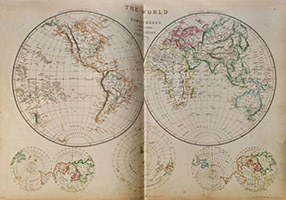
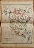
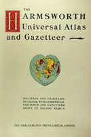
The Imperial Atlas of Modern GeographyΘΚΒέΙζœ÷¥ζΒΊάμΆΦΦ·(ΒΎ1ΑφΘ§8ΩΣΘ§1860) |

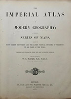

Cover of the Atlas
Title Page
Hemisphere Map of World
the Chinese Empire
|
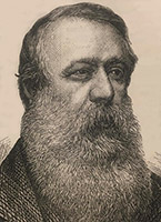
Walter Graham Blackie |
In 1860, The Imperial Atlas of Modern Geography was published by Blackie & Son. It was conceived and edited under the direction of Dr. Walter Graham BlackieΘ®Έ÷ΕϊΧΊΓΛΗώάΉΡΖΓΛ≤Φά≥γυΘ©, a Fellow of the Royal Geographical Society in London and an enthusiastic educationalist; Blackie intended his atlas to be "useful and acceptable to the general reader". His introducation states that "special promineence is given in this work to Great Britain and her colonies" and indeed, 19 images, a quarter of the whole, are devoted to this theme. |
|

|
|
North America
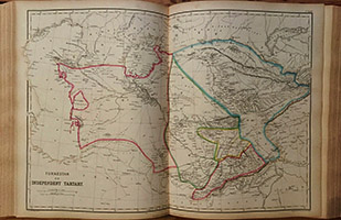
Turkestan or Independent Tartary
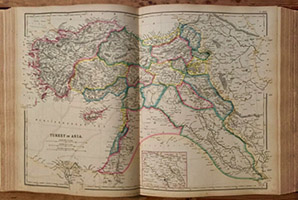
Turkly in Asia
China
|
|
| |
|
The Royal Atlas of Modern GeographyΘΚΜ Φ“œ÷¥ζΒΊάμΆΦΦ·(Ηϋ–¬ΑφΘ§¥σ8ΩΣΘ§1873) |


Cover of the Atlas
Title Page
Chart of the World
South-West Russia
|
|
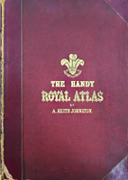
Alexander Keith Johnston(―«άζ…Ϋ¥σΓΛΩ≠ΥΙΓΛ‘ΦΚ≤ΥΙΕΌΘ§1804®C1871) was a Scottish geographer and cartographer. Johnston combined cartography with a painstaking and scholarly approach to map production. He went on to establish a reputation for scope and accuracy. Thematic atlases became the hallmark of the company he had founded and W & A K Johnston were appointed engravers to King William IV in 1834. The Royal Atlas of Modern Geography was first published in 1855 and served as an atlas of military geography to accompany Alison's History of Europe published in 1848. A variety of other atlases and maps for educational or scientific purposes. In 1856 Johnston published the "School Atlas of Astronomy". In 1861 Johnston published the first edition of the Royal Atlas of Modern Geography with 48 maps. By 1914 the atlas had gone through 12 editions and morphed into the Johnston's Handy Royal Atlas of Modern Geography with 61 colour lithographed maps and an index of 84 pages. the Royal Altlas became the standard library atlas throughout the British Empire. |

A. K. Johnston |
|


|
|
Southern Africa
India
China and Japan
1896ed of the Atlas
|
|
|
The Times AtlasΘΚΧ©Έν ΩΒΊΆΦΦ·(ΒΎ1ΑφΈΣΑΥΩΣΘ§1895-)ΘΜ Χ©Έν Ω άΫγ≤βΝΩΒΊΆΦΦ·(ΒΎ2ΑφΈΣΝυΩΣΘ§1920-) |
|
|
| |
|
The Times Atlas of the WorldΘΚΧ©Έν Ω άΫγΒΊΆΦΦ·(ΒΎ3ΑφΘ§5ΨμΝυΩΣ±ΨΘ§1955-1959) |
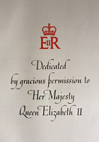


Dedicated page
Volume I (1958)
Volume II (1959)
Volume III (1955)
Volume IV (1956)
Volume V (1957)
|
|
ΡΎ“≥œρ≈°Άθ±μ¥οΒΡΧαœΉ
ΒΎ1Ψμ ¥σ―σ÷όΦΑΕΪ―«
ΒΎ2Ψμ Ές―«ΦΑΕμ¬όΥΙ
ΒΎ3Ψμ ≈Ζ÷ό±±≤Ω
ΒΎ4Ψμ ≈Ζ÷όΡœ≤ΩΦΑΖ«÷ό
ΒΎ5Ψμ Οά÷ό
|
|
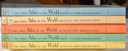
Εΰ’ΫΫα χΚσΘ§Ψ≠Ιΐ °ΡξΒΡΜ÷Η¥ΓΔΉΦ±ΗΘ§”Ύ1955ΡξΗϋΟϊΈΣΓΑΧ©Έν Ω άΫγΒΊΆΦΦ·Γ±ΒΡΒΎ3ΑφΩΣ Φ≥ωΑφΖΔ––ΓΘΒΪΒΎ3Αφ «”…‘ΦΚ≤ΓΛΑΆ»ϊ¬εγ―Θ®John BartholomewΘ©’ΐ ΫΒΘ»Έ÷ς±ύΒΡ5ΨμΝυΩΣ±ΨΒΊΆΦΦ·ΉςΤΖΘ§Ι≤”–122ΖυΆΦ“≥Θ§¥σ≤ΩΖ÷ΒΊΆΦΕΦ «ΥΪ“≥”ΓΥΔΘ§ΟΩΨμΚσΗΫ”–ΒΊΟϊΥς“ΐΘ§ΒΊΟϊ¥ Χθ ΐΝΩ≥§ΙΐΕΰ °ΆρΗωΘ§ «œΉΗχ”ΔΙζ≈°Άθ“Νάω…·ΑΉΕΰ άΒΡΚηΤΣΨό÷ΤΘ§“≤≥ΤΈΣ άΦΆ÷–“ΕΑφΓΘ¥”1955ΒΫ1959ΡξΚΡ ±5ΡξΘ®ΟΩΡξ1±ΨΘ©≤≈Ήν÷’Άξ≥…Θ§“≤ «ΉνΚσ“ΜΑφ≤…”ΟΈΛ œΉΔ“τ±ξΉΔ÷–ΙζΒΊΟϊΒΡΧ©Έν ΩΒΊΆΦΦ·Θ®»γpekingΘ§cantonΒ»Θ©ΓΘΥϋ «Χ©Έν ΩΆΦ ιΦ·Ά≈ΙΪΥΨ”– Ζ“‘ά¥≥ωΑφΒΡΧεΝΩΉν¥σΓΔΡΎ»ίΉνœξΨΓΒΡ¥σ–Ά άΫγΒΊΆΦΦ·ΉςΤΖΘ§Ά§ ±”÷Ζ÷ΈΣ”ΔΙζ¬ΉΕΊΑφΘ®±Ψ»Υ ’Φ·ΒΫΒΡΘ©ΚΆΟάΙζ≤® ΩΕΌΑφΝΫ¥σΒΊ«χΑφ±ΨΓΘ
|


|
|
”ΔΙζ¬ΉΕΊΑφ5Ψμ±Ψ
Τδ÷–ΒΎ“ΜΨμ ΡΎ“≥
ΟάΙζ≤® ΩΕΌΑφ5Ψμ±Ψ
|
|
| |
|
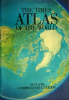
Χ©Έν Ω άΫγΒΊΆΦΦ·(ΒΎ4ΦΑΚσ–χΗςΑφΘ§άζ ΖΆΦΦ·Θ§ΚΘ―σΆΦΦ·) |


|
| 1967ΡξΒΎ4Αφ 1985ΡξΒΎ7Αφ 2011ΡξΒΎ13Αφ 2014ΡξΒΎ14Αφ 1978ΡξΑφ άΫγάζ ΖΒΊΆΦΦ· 1983ΡξΑφΚΘ―σΒΊΆΦΦ·
|
|
ΒΫ1967ΡξΘ§Χ©Έν ΩΙΪΥΨΕ‘Τδ άΫγΒΊΆΦΦ·‘Ό¥Έ»ΪΟφΗΡΑφΘ§”÷ΫΪΤδ―ΙΥθΈΣΒΞΨμΑφ±ΨΦ¥ΒΎ4ΑφΘ§“≤≥ΤΈΣΉέΚœΑφΘ§≤ΔœύΦΧΖ≠“κ≥ωΑφΝΥΒ¬”οΓΔΚ…άΦ”οΚΆΖ®”οΑφ±ΨΓΘΚσ–χΗςΑφ±ΨΜυ±Ψ―”–χΝΥ’β“ΜΑφ±ΨΒΡ–Έ ΫΚΆΖγΗώΘ§÷Μ «–ό±ύ‘ΌΑφΒΡΤΒ¬ ÷πΫΞΧαΗΏΘ§1985ΡξΒΎ7Αφ « ÷ΙΛΜφΆΦ ±¥ζΒΡΉνΚσ“ΜΗωΑφ±ΨΚΆ¥ζ±μΘ§Εχ1999Ρξ≥ωΑφΒΡΒΎ10ΑφΘ§“≤≥ΤΓΑ«ßΡξΑφΓ±‘ρΆξ»Ϊ «Ά®ΙΐΦΤΥψΜζ÷ΤΆΦΆξ≥…ΒΡΓΘΒΫΉνΫϋΗϋ–¬ΒΡ2011ΡξΒΎ13ΑφΓΔ2014ΡξΒΎ14ΑφΝ§Ά§–όΕ©ΓΔ”ο÷÷ΓΔΥθ±ύΓΔ׺ɩ»»ΉήΦΤ≥§Ιΐ20”ύΗωΑφ±ΨΘ§ «“ΜΗωΧεœΒ≈”¥σΒΡ άΫγΒΊΆΦΦ·ΉςΤΖΦ“ΉεΓΘΝμΆβΘ§Χ©Έν ΩΙΪΥΨΜΙ±ύ÷Τ≥ωΑφΝΥΕύ÷÷≤ΜΆ§÷ςΧβΓΔΉ®ΧβΒΡΆΦΦ·Θ§»γ”Ύ1978Ρξ Ή¥Έ≥ωΑφΒΡΓΕΧ©Έν Ω άΫγάζ ΖΆΦΦ·ΓΖΓΔ1983Ρξ≥ωΑφΒΡΓΕΧ©Έν ΩΚΘ―σΆΦΦ·ΓΖΓΔ1989Ρξ≥ωΑφΒΡΓΕΒΎΕΰ¥Έ άΫγ¥σ’ΫΆΦΦ·ΓΖ»»ΕΦ « άΫγΙΪ»œΒΡ”≈–ψΒΊΆΦΦ·ΉςΤΖΓΘ
|
|
| |

|
|
Μ Φ“Ά®”ΟΒΊΆΦΦ·(1896)ΓΔΜ Φ“”ΔΗώάΦΦΑΆΰΕϊ ΩΒΊΆΦΦ·(1897) |
|
|
|
ΓΕΚ’ΡΖΥΙΈ÷ΥΦΆ®”Ο άΫγΒΊΆΦΦ·≤ΔΒΊΟϊΉήάΩΓΖ(1906) |
|
 |
|
ΓΕΖΤάϊΤ’œ÷¥ζΫΧ―ßΒΊΆΦΦ·ΓΖ(c1920) |
|
| |


|
|
ΑΆ»ϊ¬εγ―Ή‘»ΜΒΊΆΦΦ·ΓΣΓΣΒΎ3ΨμΘΚΤχœσΒΊΆΦΦ·(1899) |
|
|
|
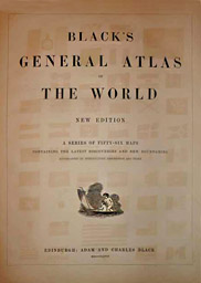
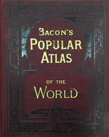
ΓΕ≤Φά≥ΩΥΆ®”Ο άΫγΒΊΆΦΦ·ΓΖΘ®1867Θ© |
|
 |
|
ΓΕ≈ύΗυ¥σ÷Ύ άΫγΒΊΆΦΦ·ΓΖ(1912) |
|
| |
|
 ΆβΙζΒΊΆΦΉςΤΖ ’≤Ί ΆβΙζΒΊΆΦΉςΤΖ ’≤Ί
|